Owner/Client
City of Martinsburg
Location
Martinsburg, WV
CEC Services
- ADA Accessibility Analysis
- Geotechnical Engineering
- Landscape Architecture/Land Planning
- Predevelopment Site Investigations
- Site Grading/Earthwork Analysis
- Site Infrastructure Maintenance/Rehabilitation
- Slope Stability/Retaining Structure Design
- Stormwater Management/BMP Design
- Sustainability Planning/Design
- Utility Design
- Aerial Photography/Videography
- Horizontal & Vertical Control Surveys
- LiDAR Surveys – Short and Long Range
- Photogrammetric and 3D LiDAR Topography
- Railway Surveys
- Route/Right of Way Surveys
- Topographic Surveys
- Construction Management
- Construction Services
- Structural Engineering
Owner Objective
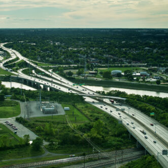
The City of Martinsburg, West Virginia wants to bring an environmentally conscious ‘Green Way’ to the area, utilizing abandoned railway stretches and existing historical routes to connect downtown Martinsburg to the existing West Virginia Route 9 Bike Path and future planned sections of accessible trails throughout the County. This ‘Green Way’ will eventually connect Oatesdale Park, Lake Thomas, War Memorial Park, and beyond.
The City aims to provide pedestrian and biker safety along the path by cleaning up the surrounding area and offering a safe and reliable route for the public to enjoy. Due to the inherent contamination present in the vicinity of railroads, it has been discussed at length what needs to be done to protect the health and safety of the public while using the trail.
CEC Approach
CEC worked with the City of Martinsburg and the contractor to devise an equitable solution for public safety, constructability, and cost. Our team utilized the existing railroad grade and ballast stone for the trail pavement subgrade, sealing any contaminants present in the base material with a crusher run base layer and a pavement cap. For areas outside of the trail path, a soil cap was provided over any materials excavated within the site. Stormwater structure repairs and replacements also occurred to support a safe pathway for pedestrians and provide more efficient water conveyance. Bioswale areas were installed for stormwater runoff treatment from the newly paved pathway.
At the head of the trail, a new stormwater detention pond was proposed in order to capture runoff from adjacent streets prior to being released into the nearby Tuscarora Creek. This pond is the central point of the ‘green space’ at the head of the trail. This area will feature a crushed stone walking path around the pond, park benches, bicycle rack, and an assortment of new trees.
Throughout the length of this approximately 1-mile trail are roadway tie-ins, removable bollards, and a three-rail fence in order to provide users with a safe continuous pathway while also preventing unauthorized vehicle use along the trail. The trail crosses three city streets, meaning that roadway striping, signage, and trail signage were necessary to provide a safer crossing for trail users and motorists.