Owner/Client
WV Department of Environmental Protection Agency
Location
Brownton, WV
CEC Services
- Erosion & Sedimentation Control/NPDES Permitting
- Geotechnical Engineering
- Site Grading/Earthwork Analysis
- Aquatic & Terrestrial Habitat Surveys
- Clean Water Act, Section 401/404 Permitting
- Ecological Risk Assessment & Land Restoration
- Threatened & Endangered Species Surveys/Wildlife Surveys
- Water Quality & Sediment Surveys
- Wetlands & Waters Delineations
- Watershed Planning and Restoration
- Horizontal & Vertical Control Surveys
- Mine Surveys and Mapping
- Volumetric Surveys
Owner Objective
The West Virginia Department of Environmental Protection (WVDEP), Office of Abandoned Mine Lands and Reclamation (OAMLR), restores land and water resources from properties mined prior to the Surface Mining Control and Reclamation Act (SMRCA) of 1977. This includes addressing dangerous hazards of mine subsidence, highwalls, open portals, open shafts, relic refuse piles, and mining-impacted water supplies. The Brownton site consists of priority 1 & 2 features including ~6,100 linear feet of unreclaimed highwalls, an ~50,000 cubic yard coal refuse pile, and two partially collapsed mine portals. Priority 3 features include two sections of clogged stream and one acid mine drainage (AMD) discharge. This property was surface and underground mined prior to SMCRA of 1977, leaving it with no liable owner and ultimately being the responsibility of the state. The WVDEP’s objective is to reclaim the highwalls, encapsulate or remove large refuse piles, install mine portal seals, install surface drains through non calcareous channels, and revegetate the site with landowner end use in mind.
CEC Approach
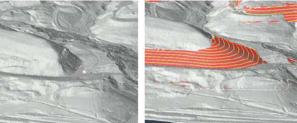
Project development included baseline ecological data collection, water quality sampling, surveying, geotechnical investigations and analysis, earthwork grading and analysis, and engineering plan production including development of technical specifications and opinions of cost. CEC had to take into consideration the National Environmental Policy Act (NEPA), Endangered Species Act (ESA), and Clean Water Act (CWA) for this site. A surface water delineation and approved jurisdictional determination were completed to identify Waters of the U.S. and a Phase 1 habitat assessment and emergence harp trap surveys were conducted for threatened and endangered bats. Water quality sampling was assessed for acidity, alkalinity, and metals. The geotechnical investigation assessed site soils and refuse for physical parameters including composition, compressive & and shear strength, and chemical parameters including acid-base accounting, sulfur forms, and nutrient content for revegetation planning. The engineering approach utilized Civil 3D software to grade features and analyze earthwork volumes. Engineering drawings were produced at the conceptual, preliminary, and final (90%) stages for WVDEP review. The project is ongoing with construction forthcoming.