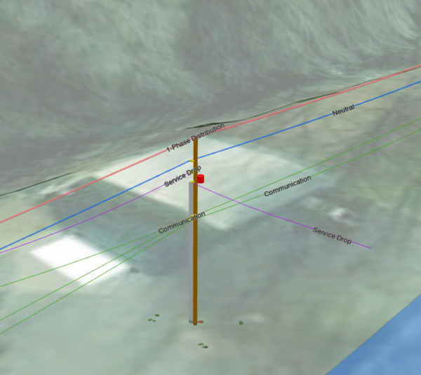
CEC constructs 3D GIS models of power distribution networks from LIDAR data. These models include attribute-driven clearance measurements for all facility-attached features to assess NESC compliance.
CEC combines semi-automated classification and expert manual refinement using Trimble Business Center and Terrascan to process LiDAR data efficiently and accurately.
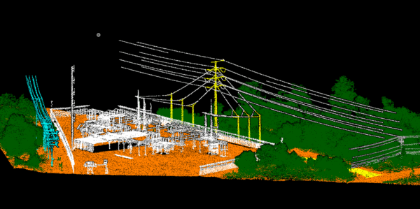
Once the LiDAR is classified, we import the files into PLS-CADD to model the geometry of each utility pole and span wire. This geometric data is then compiled in ArcGIS Pro, where we build a robust GIS model that supports data visualization, analysis, and planning.
In ArcGIS Pro, each pole is assigned a unique identifier, and every span wire is categorized based on its function—such as 1-Phase or 3-Phase Distribution power, Neutral, Communication, Cross-Guy, and more. We then use these classifications to calculate accurate clearance measurements between wires and poles.
The final deliverable is provided as an ArcGIS Pro Package. This process ensures highly accurate clearance data that can support system upgrades, reliability assessments, and permitting.