With a seasoned team of registered professionals and survey staff, combined with cutting-edge technology and equipment, CEC offers a full range of surveying and geospatial services both on land and in water that meet the changing needs of clients.
Land Surveying
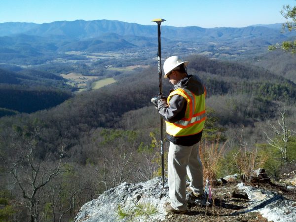 CEC surveyors have a depth of professional experience combined with advanced technical skills to locate, analyze, and map property boundaries and existing conditions for a variety of land use and development purposes. From reviewing aged deeds to utilizing the latest survey technology, reconciling boundary and title exceptions, and preparing high-quality documents and deliverables, CEC surveyors are proven expert measurers. Licensed professionals are experienced with various agency and governmental requirements, as well as state and national survey standards. Robust professional capabilities, specialized experience, and technical competence and capacity allow CEC to provide the following surveys:
- Boundary and ALTA/NSPS Land Title
- Topographic, Utility, and As-Built
- Horizontal and Vertical Control
- Construction Surveys and Staking
- Volumetric
- Settlement and Deformation Monitoring
- Route and Right-Of-Way
- Roadway and Railway
Bathymetric/Hydrographic Surveys
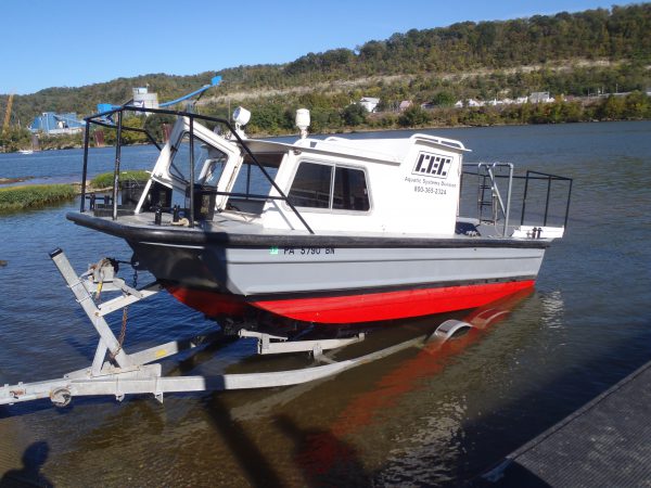 CEC performs bathymetric/hydrographic surveys using its in-house fleet of survey vessels and depth-sounding equipment to satisfy diverse industry needs for mapping underwater environments. Our vessels are outfitted with required United States Coast Guard (USCG) safety equipment and are operated by CEC personnel with a USCG Captain’s License and/or safe boat operation training, and who have been trained to work in aquatic environments.
CEC collects comprehensive bathymetric data to assist manufacturing, mining, natural gas, power, and transportation companies with projects requiring accurate water depth/ bottom surface elevation data. Capabilities and services include:
- Dual-Frequency and Side-Scan Capabilities
- Manned and Autonomous Survey Vessels
- Pre- and Post-Dredging and Demolition Surveys
- River, Harbor, and Impoundment Surveys
- Maintenance Dredging Scans
- Draft and Trench Verification
- Storage Volumes and Resident Time Calculations
- Utility Crossing Alignment Surveys
- Horizontal Directional Drilling (HDD) Scans
Unmanned Aerial Systems (UAS)
CEC utilizes UAS to conduct site inspections, topographic surveys, construction site monitoring, stockpile and landfill volumetric calculations, vegetation analyses, optical gas imaging, and other similar projects. UAS provide a cost-effective, low-environmental-impact solution that optimizes the quality and value of collected data.
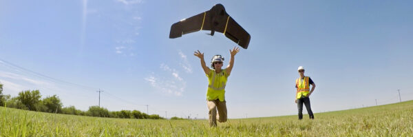
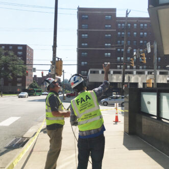
CEC obtained a Federal Aviation Administration (FAA) Section 333 Exemption and FAA Part 107 Pilot Certifications to operate robotic UAS within the national airspace system for the purpose of conducting aerial data acquisitions. The use of UAS enables CEC to conduct data acquisition for project sites in a safe manner. The use of UAS also creates significant economic efficiencies, such as reductions in the number of field personnel required and the time required for both data acquisition and review. Applications of the technology include:
- Aerial Photography and Videography
- Photogrammetric and 3D Light Detection And Ranging (LiDAR) Topography
- Optical Gas Imaging (OGI) and Pipeline Leak Detection
- Vegetative Analysis and Thermal Imagery
- Visual Façade Inspections
- Volume Determinations
- Right-Of-Way Monitoring
3D LiDAR Scanning and Imagery
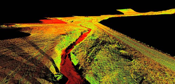 CEC provides a wide range of land surveying services with a full complement of cutting-edge technology, including 3D LiDAR scanning to create spatial imaging. With ease of portability and setup, and decreased data processing time, LiDAR scanning provides significant time savings versus traditional location methods. The use of LiDAR technology also enables increased safety by minimizing the need to send crews into dangerous spaces.
Using LiDAR, CEC can create an extremely detailed and dimensionally accurate 3D image using millions of acquired intelligent data points on a project site. Services include:
- Topographic Scanning
- Architectural LiDAR Surveys
- Mobile LiDAR Surveys
- Bridge Surveys
- Mine Surveys and Mapping
- Asset Management Surveys
- Industrial and Manufacturing Scanning
- Landslide and Deformation Surveys
- 360-Degree Imagery
- Orthorectified Imagery