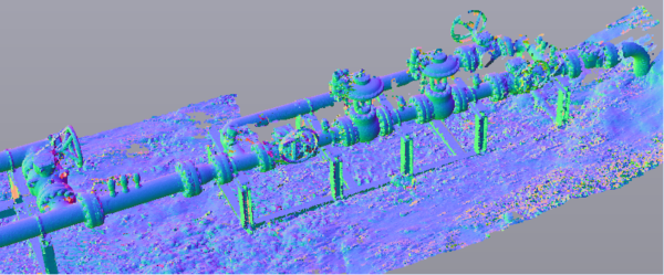
Civil & Environmental Consultants, Inc. (CEC) utilizes laser scanning technology to acquire highly accurate point cloud information for oil & gas clients. By establishing an accurate control network and registering LiDAR data to this system of control, clients can easily incorporate point cloud data in existing CAD drawings or Navisworks models using the Autodesk ReCap files provided.
Construction Monitoring
CEC acquires detailed scans throughout the construction process to aid our clients in a variety of ways. After footers and bolt patterns have been established, we can verify the locations and elevations of these elements prior to the erection of structural steel and piping on-site. This level of verification mid-project helps to minimize change orders and re-work as the construction progresses. While underground piping and conduit is exposed, the acquisition of LiDAR provides accurate location, size, and depth of these underground features. Knowledge of these underground locations aids the operator in construction and maintenance tasks for years to come, minimizing the risk associated with unknown locations of underground utilities.
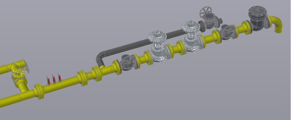
As-Built Models
For clients wishing to have CAD objects of their assets, CEC provides as-built building information modeling (BIM) created from the LiDAR data in Autodesk® Plant 3D, Revit, or AutoCAD® formats.
Truview Global
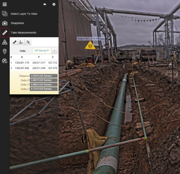
CEC provides clients with web access to each scan through TruView Global. All data is hosted on redundant web servers, and clients are provided with their own portal and login credentials for this service. Through the TruView interface, each scan can be viewed in 3D, markups can be added for team collaboration and discussion, and measurements can be taken directly from the LiDAR data.