CEC utilizes LiDAR and drone technology to perform remote crane alignment surveys, which leads to lower maintenance costs for clients and ensures proper operation of cranes in industrial facilities.

Overhead traveling cranes are common in many industrial facilities, and proper alignment of the crane and associated rails and girders is vital to minimizing maintenance costs and ensuring successful operation of the crane. CEC’s LiDAR and drone survey techniques provide a rapid and accurate assessment of multiple aspects of alignment deviations and visual assessment of the condition of the crane and supporting structural supports.
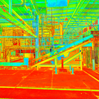
LiDAR Scans
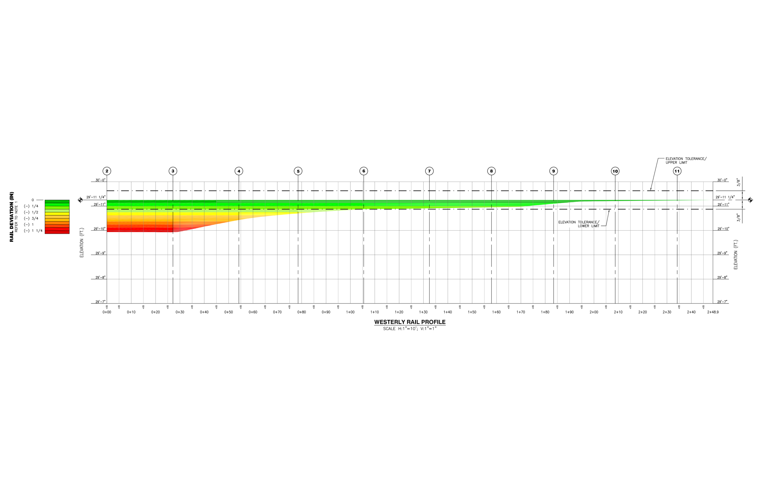
CEC utilizes LiDAR technology for mapping the vertical and horizontal alignment of an elevated crane runway. Using LiDAR mapping instead of current conventional methods for checking runway alignment results in a significantly more accurate alignment representation of the crane and the various runway components.
Results of the LiDAR scans are subsequently compared to the Crane Manufacturers Association of America Specification 70 – Specification for Top Running Bridge and Gantry Type Multiple Girder Electric Overhead Traveling Cranes for:
- Center-to-center span
- Straightness
- Elevation
- Rail-to-rail elevations
Deviations as small as a fraction of an inch can be identified using this technique, allowing crane owners to identify where excess wear may be expected or where maintenance is required so as to comply with specifications.
Drones
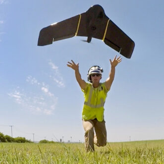
CEC utilizes drones equipped with video capabilities for the purpose of conducting a visual inspection of the steel structure without the need for personnel to physically access the runway. In addition, the use of drones offers the following additional benefits:
- Video can be viewed in real-time by a certified inspector to identify areas of potential concern immediately
- The survey provides a historical video record