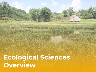
Finding balance…
Between business objectives and ecological impact
Our ecological sciences practice solves the wide range of ecological issues you may confront during your project. With extensive experience working with regulatory agencies, our multi-disciplinary team includes terrestrial and aquatic ecologists, wetland scientists, threatened and endangered species experts, and agency-approved surveyors of federally and state-listed plants and animals. We determine the presence or absence of protected species, offer measures to provide mitigation solutions, work with regulators to resolve conflicts, and recommend a permitting strategy.
- Wetland and Stream Delineations
- 401/404 Permitting for Wetland and Stream Encroachments
- Jurisdictional Determination (JD) Meetings with Regulators
- Wetland and Stream Functional Assessments
- Alternatives Analysis
- Cumulative Impact Assessments
- Mitigation Design, Construction Oversight, and Success Monitoring
- Mitigation Construction Bid Documents
- Design of Wetland Treatment Systems
- Stream and Wetland Restoration Design
- Site Selection and Evaluation
- Fluvial Geomorphic Assessments
- Natural Channel Design
- Riparian and Wetland Planting
- Mitigation Planning
- Landscape Restoration
- Revegetation of Disturbed Landscapes
- Invasive Plant Management
- Watershed Planning
- Regulatory Permitting
- Aquatic Biological Monitoring (Fish and Benthic Macroinvertebrates)
- Geographic Information and Database Management Systems
- Design-Build Services
- Construction Specifications and Bid Packages
- Construction Management and Quality Assurance
- As-Built Drawings and Certification Reports
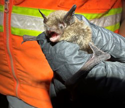
- Surveys for Plants, Bats, Birds, Fish, and Mussels
- Rare Plant Surveys, Mitigation, and Agency Coordination
- Habitat Assessments
- Conservation and Mitigation Plans
- Bat Habitat Assessments
- Bat Mist-net and Harp-trap Surveys
- Mine/Cave Portal Surveys
- Radio Telemetry and Tracking
- Acoustic Detection and Analysis
- Federal and State Agency Consultation
- Habitat Mitigation
- Habitat Conservation Plans (Section 10)
- Biological Assessments (Section 7)
- Fisheries Surveys
- Benthic Macroinvertebrate Surveys
- In-House Benthic Laboratory for Benthic Processing and Identification
- Aquatic Functional Assessment
- Water Sampling
- Bathymetric and Hydrographic Surveys
- Side-Scan Sonar
- Freshwater Mussel Surveys
- Rare Aquatic and Wetland Plant Surveys
- Passive Treatment Systems (Including Wetland Treatment, AMD Treatment)
- Biofouling Organism Monitoring
- Clean Water Act Section 316 (a) (b)
- Habitat Evaluations
- Pond & Lake Management

Ray Ewing
Ecological Sciences Lead
Ray Ewing
Mr. Ewing is an ecologist and principal at CEC. He has more than 15 years of experience in managing and conducting ecological surveys. As CEC’s corporate Ecological Sciences Practice Lead, Mr. Ewing is responsible for assisting and coordinating the firm’s technical capabilities; maintaining consistency and quality of work product; and identifying, acquiring, and developing necessary personnel across the company. Mr. Ewing has been with CEC since 2010.


Who We Serve
Multi-disciplined teams strategically focus on the drivers and challenges of the markets we serve to provide better insight and better outcomes for our clients. Explore the markets we serve: